How do you explain the attraction of the Pacific Northwest to a visitor? You might focus on the political, the cultural – or even the meteorological climate. Or you might begin with the geography – the physical shape of the mountains and the coast, and describe the ways that sea and shore meet and create such an infinite variety of forms.
Where else in the world can you find glaciated mountains within a few miles of coastal cities and fine harbors? Having spent 30 of those years enjoying this incomparable environment, I found myself reflecting on this sense of place. Over the winter this became an effort to create a framework for a voyage of some kind around our northwest waters. It would need to challenge my abilities, combine several landmarks and hopefully give me a new perspective on the region I call home.
During my research I had also come across the Three Peaks Race, In 1972, a couple of Welsh sailors were discussing their local sailing legend, Major H.W.Tilman, at the bar of the Merioneth Sailing Club. Dr Robert Haworth was explaining to his partner, Dr Merfyn Jones, his idea for a challenging summer cruise that wouldn’t involve sailing half-way around the world, as Tilman’s often did.
Haworth wanted to cruise the Irish Sea with his family and climb the highest peaks in Wales, England and Scotland along the route. Jones responded that they should make a race of it – and the Three Peaks Race was born. The first running in 1977 coincided with the Queen’s Jubilee celebrations marking 25 years on the throne and 22 boats showed up.
Right from the start, the Three Peaks was a truly amateur event with very few rules, offering everyone the chance of a real adventure within home waters. Tilman willingly agreed to be the race’s patron and met with the race committee. His Spartan attitude was reflected in the race rules which allowed any form of human power. The race didn’t favor big boats because of the extremely shallow entries to the fishing villages that marked the start of the running legs.
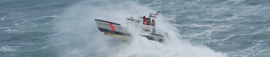
The first winner was the 39′ Samphire, entered by the Royal Marines. The winning skipper described that first race as “mildly eccentric” but found running up an down mountains a great cure for seasickness! Tilman died before the second running, and may not have been gratified by the high-tech approach to the race these days. But he would have appreciated that it is still the crew’s hard work that counts the most.
It wasn’t long before the multihulls began getting into the act, while the monohulls responded with human-powered propulsion systems, ranging from giant oars to sophisticated pedalling set-ups. The crews began to recruit champion sailors, oarsmen and hill runners. This insanity spread to Australia in 1987 and Scotland in the 1990s.
The overall distance is 389 miles, which includes some of the most intricate navigation included a passage through a rock-lined tide rip between Anglesey and Wales for the Welsh stop, through sandbanks for the English stop and around the wind-swept isles of Scotland for the last leg. The climbs average a marathon (26 miles) in length, 3-4,000′ elevation gain and take around three hours round-trip. The record is a phenomenal 2 days, 8 hours.
We are truly surrounded by mountains here and I felt t the northwest simply had to have a Three Peaks course of its own. The Olympic mountains were the first land sighted by the early explorers, who made great efforts to locate and identify the peaks, which would become the best aids to navigation for the next 200 years. The first honors went to the Spanish captain Juan Perez, when he located the fabled straits described by the mysterious Juan de Fuca on August 10th, 1774. He named the high point of the range in typical Hispanic style as “El Cerro de la Santa Rosalia.” (A few days later he was more successful in naming the San Juan Islands.)
Olympus was the next name given to the mountain by Englishman John Meares in 1784 – he thought it looked like a suitable spot for the gods to reside. In 1792 George Vancouver extended the name to cover the whole range. All these sailors must have been impressed by the superbly protected harbor created by the Ediz Hook, a great relief after they had weathered the forbidding coastline north of San Francisco. This was then the last unexplored land in the continental U.S. and the the first crossing of the Olympics was by the Seattle Press Expedition in 1889. They took three months to fight their way across.
Further east, the best access to Mount Constitution is via the village of Olga on the East Sound of Orcas Island. Depending on the tide, it may be more effective to sail up the Rosario Strait and use the Thatcher or Obstruction Passes, rather than time the passage through the San Juan Channel, the southern entrance to the San Juans.
We headed to the landmark in Olga, the popular restaurant and gallery housed in a converted strawberry packing plant. In the 1930s, strawberries were a big cash crop on the island, but the war closed the business down and it never revived. It’s a couple of miles to the two-lane road to the top of Mount Constitution which turns off the main, island road just outside Moran State Park.
I wanted to avoid the traffic, so cycled 3 miles to the Cascade Lake campground in the park and began hiking on the Cold Creek Trail. During the two-hour climb, in the quiet of the forest, I saw that my race had comfortably turned into a pilgrimage to this high point. The summit, at 2,454′ is topped by a lookout built in the 1930s, and said to resemble a “Caucasian watchtower of the 12th century.” I can’t vouch for that, but the view is superb. From up there you can see the horseshoe shape of Sucia, look down on Cypress Island, itself 1530’high, and view sailboats as white flecks on the water. This high spot has been popular with tourists since the 1870s and was donated to the state by Robert Moran, the same man who built Rosario. Commander Wilkes had named the peak in 1841, not after the document but after the famous ship the USS Constitution.
Third Lieutenant Joseph Baker had sighted the 10,778′ peak dominating the eastern skyline on a clear day in April in 1792 and Vancouver had named it after him – having already used his patrons names like Hood and St Helens on earlier features on the Columbia. It had been given a Spanish name a couple of years earlier during the voyage of Manuel Quimper. His pilot Gonzalo Lopez de Haro had name it Montana del Carmelo, because its snow-clad slopes looked like the white robes of Carmelite monks.
Fortunately, later efforts to re-name it Mount Polk failed, but Mount Carmel does have a nice ring to it! The first man to climb Mount Baker in 1868 was an English gentleman and scholar Edmund Coleman who was living in Victoria. He actually spent 10 days in a series of boats before reaching the mountain’s glaciers. Beginning with a steamer to Port Townsend, he then hired a native canoe to carry him through the San Juans, where he passed the opposing garrisons on San Juan.
There were already two, competing towns on Bellinghamn Bay, Whatcom and Seahome, both exploiting seams of coal. Coleman visited both before finding a river canoe to carry him up the Lummi River, into “the bosom of the forest.” There he was presented to the Chief of the Nooksacks and left his canoes to continue on foot.
BILL TILMAN
In the words of his biographer, J.R.L. Anderson, Bill Tilman “contrived to live a life on a physical scale unmatched by anyone in this century.” At the age of 18, he became an officer in the trenches in World War I, and fought through the bloody Battle of the Somme. In World War II, he survived Dunkirk and El Alamein, then parachuted behind enemy lines and fought with the Albanian partisans. After trying his hand at farming in Kenya in the 1920s, Tilman had been at the forefront of Himalayan exploration and climbing in the 1930s and led the 1938 Everest expedition.
In 1954 he bought an old, Bristol Channel Pilot Cutter named Mischief and sailed 114,000 miles, exploring in the high latitudes until 1968 when she was lost off Jan Mayen Island, far north of the Arctic Circle. In the following decade he bought two more old cutters and visited Greenland or the Arctic islands on nine successive summers.
He was close to 80 years of age when he made his last voyage to Smith Island south of Cape Horn in 1977. He had accepted the position of navigator on the converted, steel-hulled tug En Avant, which disappeared off the Falkland Islands without a trace. He was very much the Victorian gentleman-adventurer, the last of his kind.
Tilman’s independant voyages were a new departure in the yachting world, combining cruising and mountaineering in the most hostile conditions on earth. He wrote seven books on climbing and eight on sailing. I joined his 1971 voyage to Greenland and have been inspired by his combination of sailing and climbing ever since.
Two corrections:
1. the Press Exploring Expedition took approximately five months, not three months. The expedition embarked from Seattle on December 8, 1889 and reached the Pacific Ocean on May 20, 1890.
2. The name of the first platted townsite on Bellingham Bay is spelled Sehome, not Seahome. It was named after the Sehome coal mine. Sehome was the name of a chief of the Samish tribe.